KYRGYZMAP · TRAVEL GUIDE
Places to visit in Kyrgyzstan
From Bishkek’s museums to the valleys of Batken, these 32 places offer a starting point for planning a journey across all seven regions of Kyrgyzstan, plus Bishkek and Osh. Choose a region below, then open an individual guide for its map, access, season and sources. Mountain and border-area visits need their own preparation; this selection is not a single itinerary.
Bishkek
Bishkek
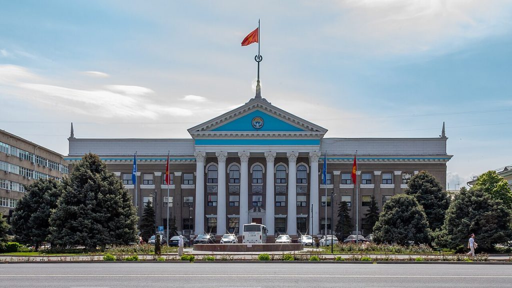
Bishkek gives a journey through Kyrgyzstan an urban starting point: broad avenues, public squares, museums and everyday neighbourhood life beneath the mountains. Allow a separate city day instead of treating every available hour as a transfer window. The central streets make it possible to combine several cultural stops without turning the visit into a long road excursion.
Ala-Too Square
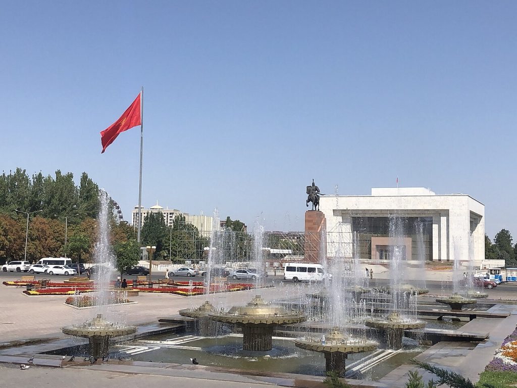
Ala-Too Square is a natural starting point for a first walk through central Bishkek. Its open space, monuments and surrounding public buildings bring national symbols and everyday city life into the same view. Rather than stopping only for a photograph, take time to notice how the square connects with nearby museum buildings, parks and streets.
Chui Region
Ala-Archa National Park
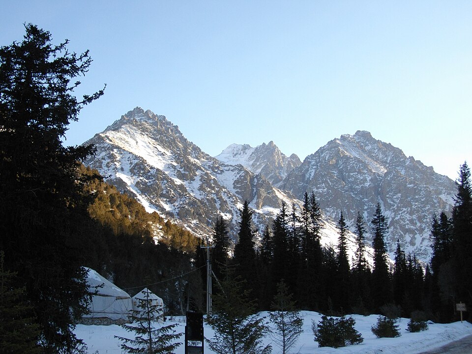
Ala-Archa brings the high Tian Shan within reach of a day trip from Bishkek. The river valley leads from juniper-covered slopes towards rocky peaks, glaciers and increasingly demanding mountain paths. Visitors can choose a short riverside walk or plan a longer hike with suitable preparation.
Burana Tower and Balasagun
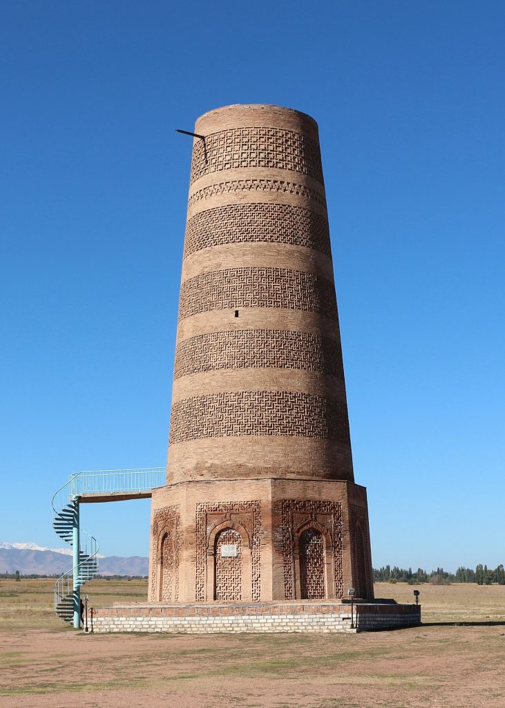
Burana Tower rises above the remains of Balasagun near Tokmok. The brick minaret is the most visible part of a much larger medieval city, one of the Kyrgyz components of the UNESCO Silk Roads corridor. Walking around the surrounding archaeological landscape helps put the tower in context: this was a place of trade, settlement and cultural exchange.
Chon-Kemin National Park
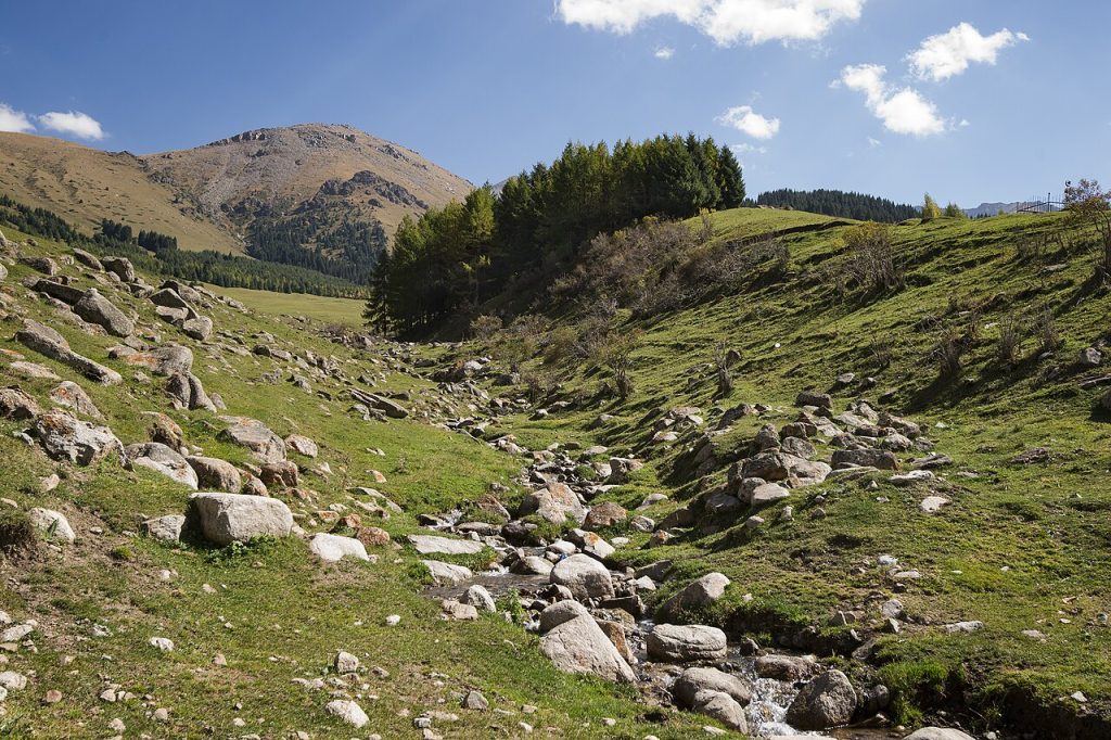
Chon-Kemin is a broad mountain valley where rural settlements, pastures, woodland and the river form a landscape best explored slowly. The national park protects a large area, so a map marker represents the park rather than a single entrance or attraction. Travellers can base themselves in a village and choose walks or horse rides appropriate to the season.
Issyk-Kul Region
Issyk-Kul Lake
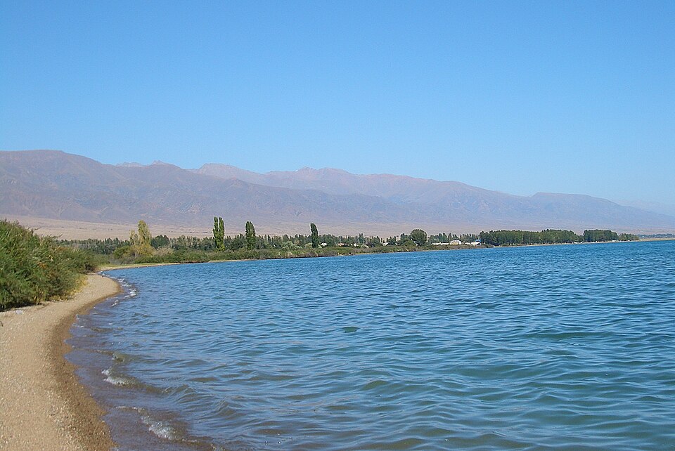
Issyk-Kul is the great lake at the centre of eastern Kyrgyzstan’s best-known travel circuit. Its broad water surface lies between mountain ranges, with very different experiences around the shore: resort towns, small villages, beaches and access roads into alpine valleys. Rather than treating the lake as one stop, choose a stretch of coast that matches your interests and leave room for nearby walks.
Karakol
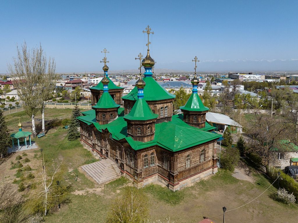
Karakol deserves time as a city as well as a base for the eastern Issyk-Kul mountains. Its streets bring together the histories of different communities, with wooden architecture, places of worship and food traditions that make a useful counterpoint to days on mountain trails. A city walk is a worthwhile part of the journey in its own right.
Jeti-Oguz: Seven Bulls Rocks
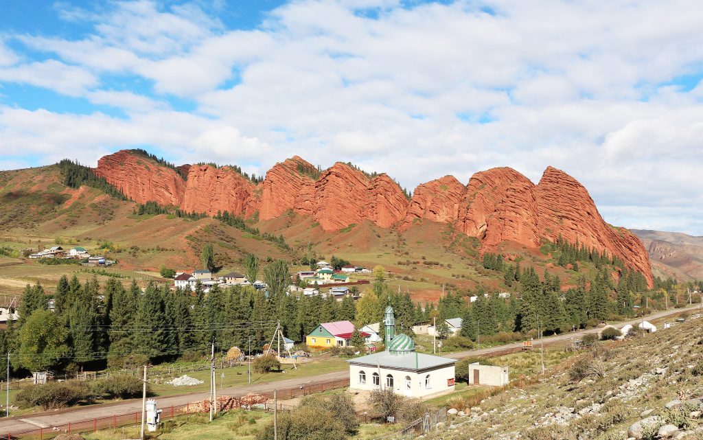
The red rock wall known as the Seven Bulls is the signature sight of Jeti-Oguz. It stands near the entrance to a mountain valley southwest of Karakol, where the exposed red formations give way to greener slopes and higher pastures. A short visit can focus on the rocks and surrounding viewpoints; a longer day can continue into the valley if conditions allow.
Skazka: Fairy Tale Canyon
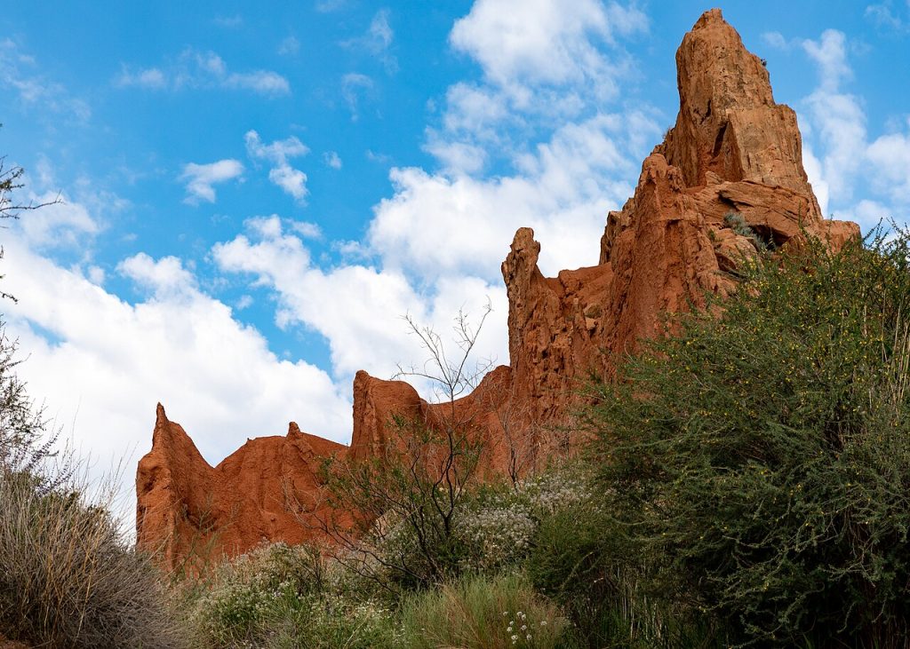
Skazka, or Fairy Tale Canyon, is a compact landscape of coloured ridges and weathered rock near Issyk-Kul’s southern shore. Its appeal is in changing viewpoints: familiar-looking silhouettes appear and disappear as you walk through the folds of the terrain. It can fit into a south-shore journey without a high mountain expedition, but the ground is loose and exposed.
Barskoon Waterfalls
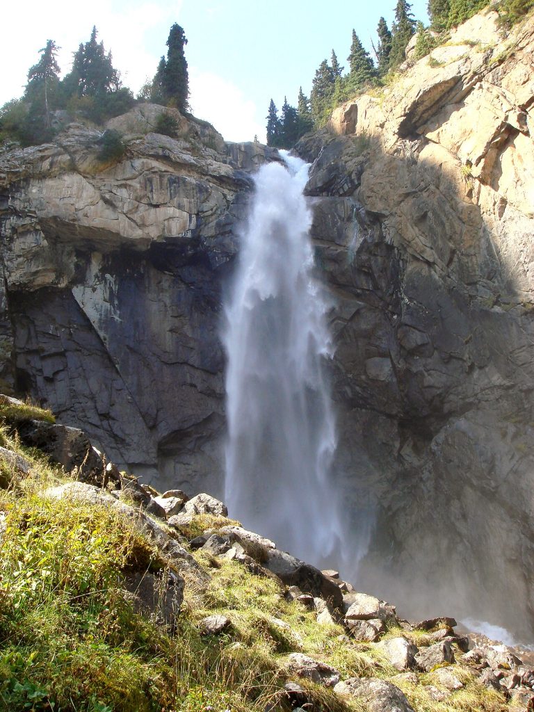
Barskoon is a gorge outing with several cascade approaches rather than a single viewpoint reached by stopping on the lakeshore road. Choose the intended waterfall and allow for the climb from the valley. Wet rock, roots and steeper sections make the final walk different from a roadside picnic.
Ala-Kul Lake
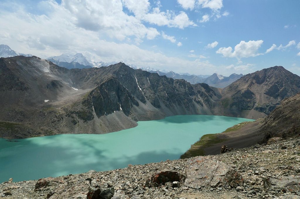
Ala-Kul is a high mountain lake in the ranges south of Karakol, valued for its changing blue-green water and steep alpine setting. Reaching it is a serious hiking objective involving altitude, uneven ground and weather that can change quickly. Many itineraries include a pass and several days in the mountains, although the exact route depends on the starting point.
Naryn Region
Song-Kul Lake
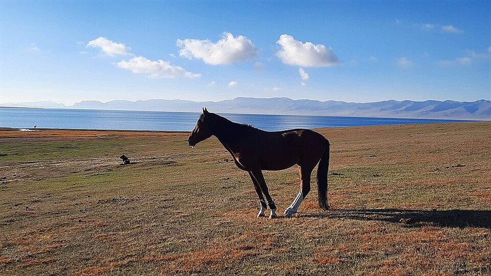
Song-Kul sits in a broad highland basin where water, sky and summer pasture dominate the view. Seasonal yurt camps and grazing herds are part of a working landscape rather than a permanent resort town. Travellers come for walks, horse riding and time with local hosts, often staying overnight to experience the changing light and cold mountain evening.
Tash Rabat Caravanserai
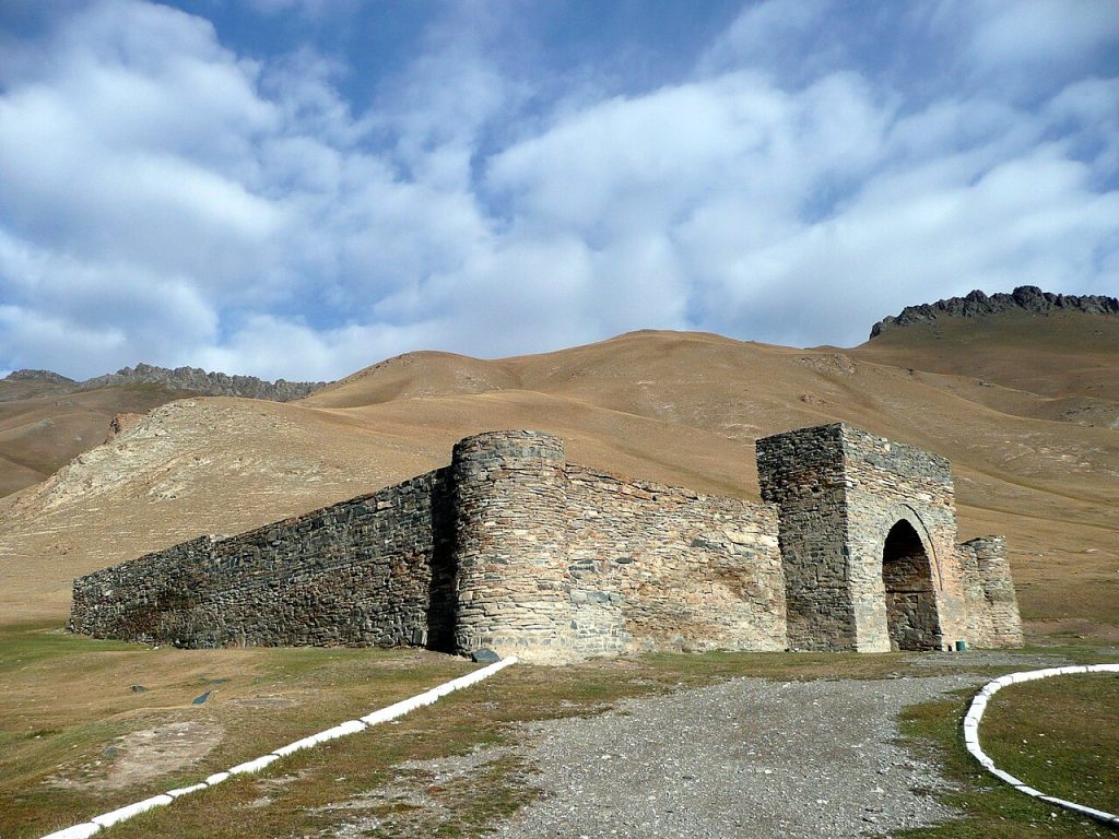
Tash Rabat is a stone caravanserai in a mountain valley south of Naryn. Its enclosed rooms, heavy masonry and domed spaces make the relationship between architecture and the surrounding travel landscape especially vivid. The building is often visited on a journey through the At-Bashy area, with time for a valley walk as well as the interior.
Kel-Suu Lake
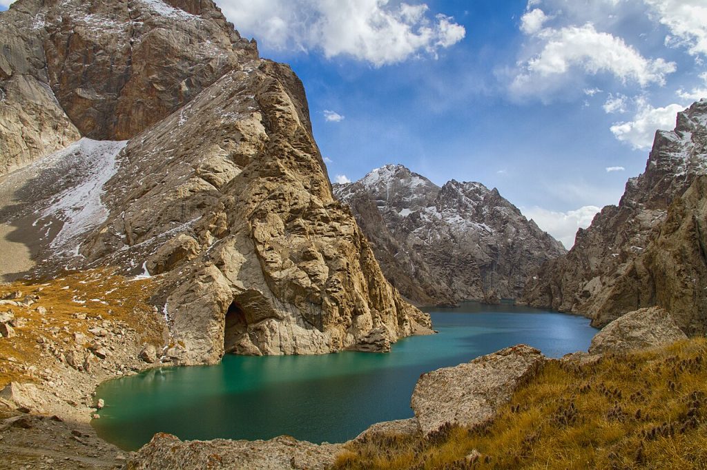
Kel-Suu is a remote high mountain lake enclosed by steep rock walls in the south of Naryn Region. Getting there is an expedition-style journey with a long road approach and a final walk or horse ride, rather than a simple stop on the way to another town. The lake lies in a border area, so permits and current access arrangements need checking before departure.
Kochkor
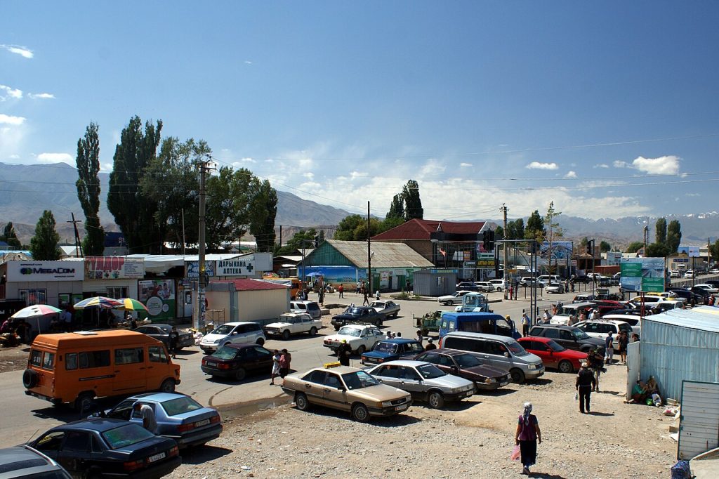
Kochkor is a village in Naryn Region and a starting point for trips to the surrounding mountain pastures. Local crafts include Kyrgyz felt-making.
Talas Region
Manas Ordo Memorial Complex
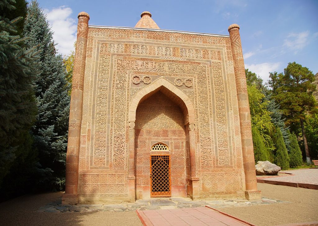
Manas Ordo near Talas is a memorial landscape devoted to the epic tradition of Manas, one of the central reference points of Kyrgyz cultural identity. The complex brings together a historic mausoleum, museum interpretation and spaces associated with commemoration and storytelling. A visit is most rewarding when the epic and local traditions are explained alongside the architecture.
Besh-Tash Nature Park
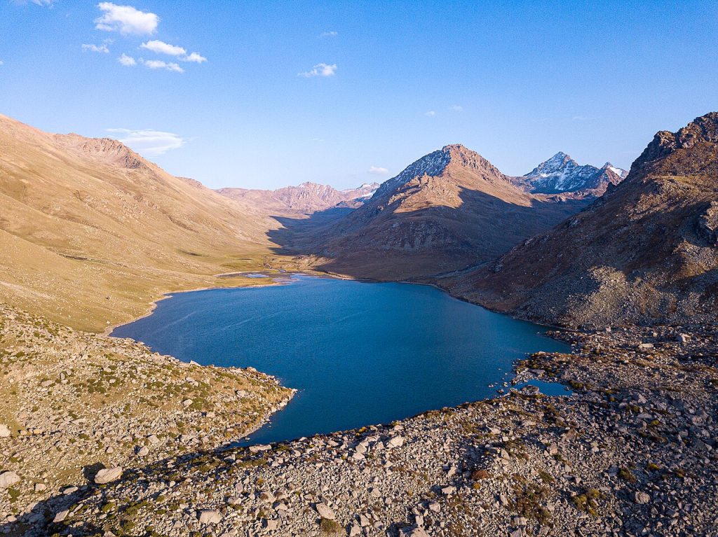
Besh-Tash is a mountain nature park south of Talas, combining river valleys, wooded slopes and higher pasture landscapes. It offers a useful choice between a shorter nature outing and a more demanding trek, provided those options are planned separately. The upper lake is not the same destination as the lower park’s accessible picnic areas.
Kirov Reservoir
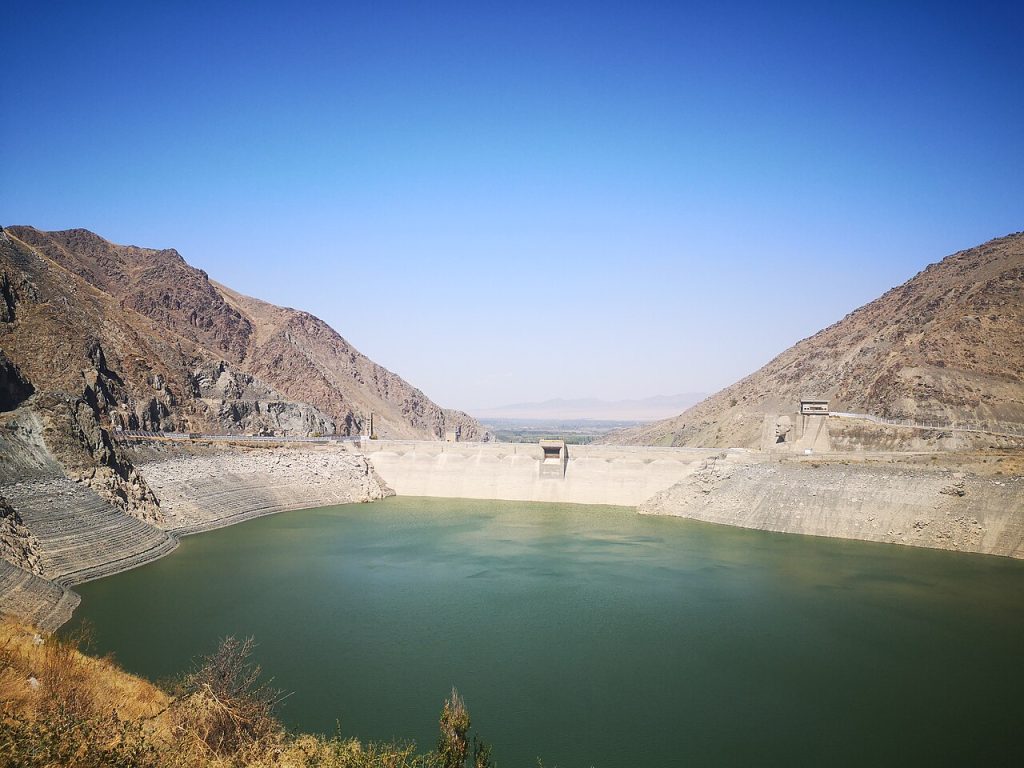
Kirov Reservoir creates a broad water landscape in western Talas Region, contrasting with the enclosed mountain valleys farther east. It is an engineered reservoir serving practical purposes, so public access should be distinguished from restricted infrastructure. Visitors can enjoy shoreline scenery from suitable, locally confirmed places and combine the stop with travel through nearby villages.
Jalal-Abad Region
Sary-Chelek Lake
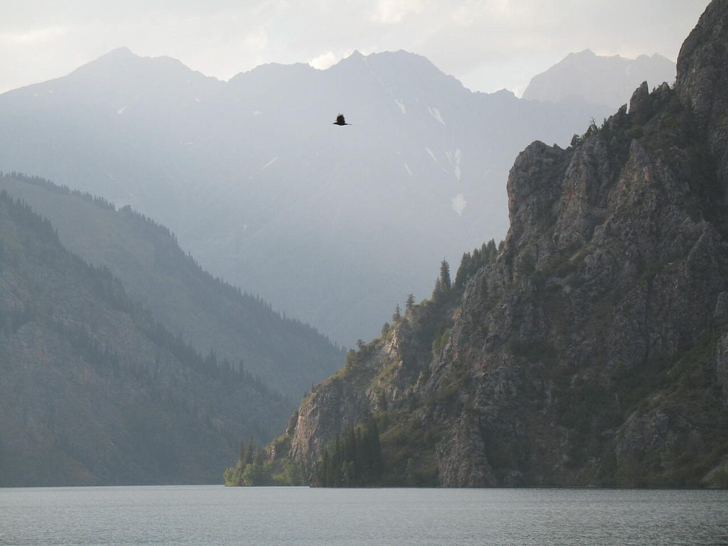
Sary-Chelek lies within a protected mountain landscape in Jalal-Abad Region, surrounded by wooded slopes that give it a different character from Kyrgyzstan’s open high plateau lakes. Visitors usually approach through the village of Arkyt and plan time for both the lake and its forest setting. This is a nature reserve, so walks, shore access and overnight arrangements need to follow local rules.
Arslanbob Walnut Forest
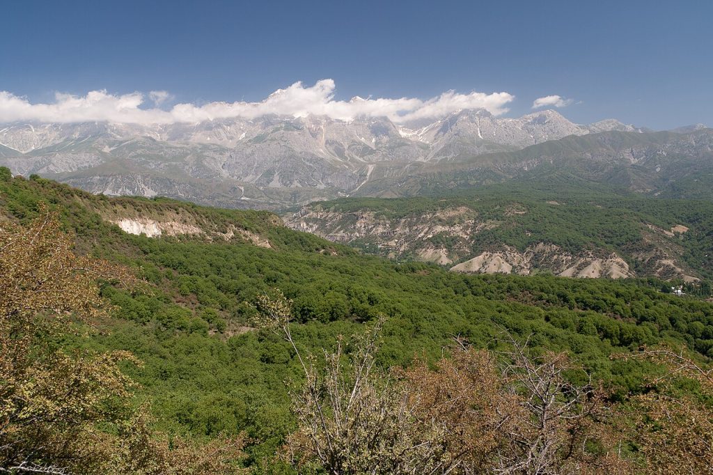
The walnut-fruit forest around Arslanbob is a living landscape connected with village households, seasonal work and local traditions. A walk here offers shade, varied woodland and a chance to understand why forest resources matter to the community. It is best explored with a local host or guide who can explain paths and access, especially during gathering seasons.
Toktogul Reservoir
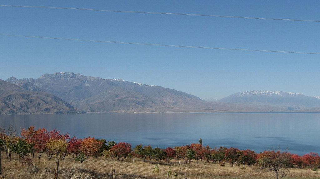
Toktogul Reservoir opens into a vast water landscape along the journey through central Jalal-Abad Region. The reservoir’s shores and surrounding hills offer striking views, particularly when approached after the enclosed valleys of the north–south road. It is also a working part of the country’s water and energy infrastructure.
Saimaluu-Tash Petroglyphs
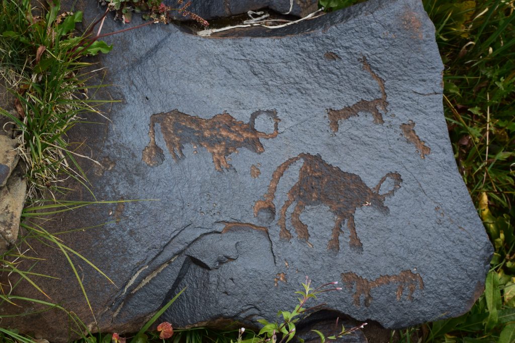
Saimaluu-Tash is a high mountain field of carved stones, bringing a remarkable archaeological experience into an environment that demands serious travel preparation. The petroglyphs should be seen as a cultural landscape, not a set of loose objects to handle or rearrange. Reaching the site commonly involves an organised mountain approach from the Kazarman area, with a limited seasonal window.
Osh city
Sulaiman-Too Sacred Mountain
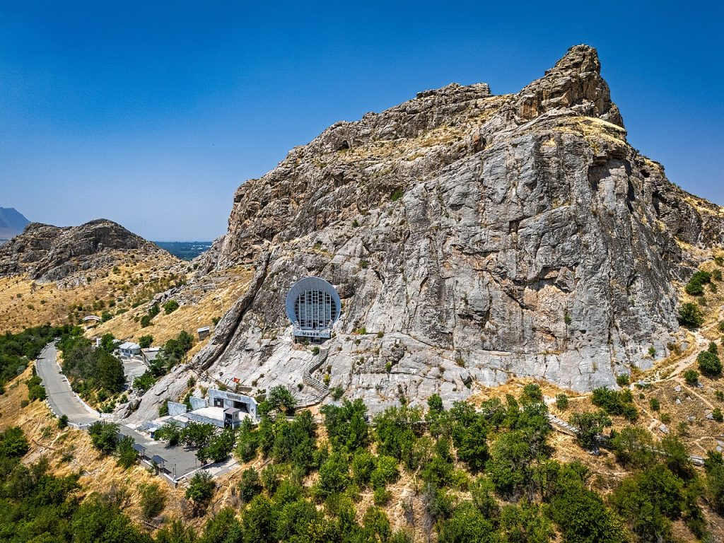
Sulaiman-Too rises within Osh as a five-peaked sacred mountain. UNESCO inscribed the cultural landscape in 2009, recognising the long interaction between a striking natural landmark and religious practice. Rock art, shrines, caves, worn paths and buildings belong to different periods.
Sulaiman-Too Cave Museum
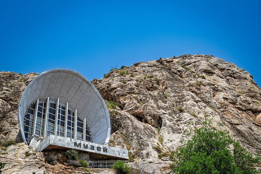
The museum associated with Sulaiman-Too gives a different perspective on Osh’s sacred mountain from the open walking paths. Its cave setting makes the relationship between exhibition space and natural rock part of the visit. Ask which sections of the museum complex are currently open, because the wider institution and the mountain include more than one building or visitor area.
Osh Region
Uzgen Minaret and Mausoleums
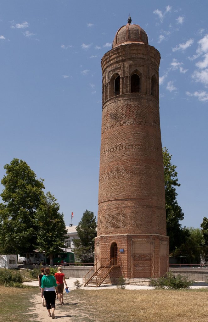
Uzgen’s minaret and mausoleums are among southern Kyrgyzstan’s most important surviving examples of medieval Islamic architecture. The brickwork and the relationship between the monuments reward a close, unhurried look rather than a quick photograph of the tower alone. The complex belongs to the history of a town shaped by trade routes and settled life in the Fergana Valley.
Abshyr-Ata Waterfall
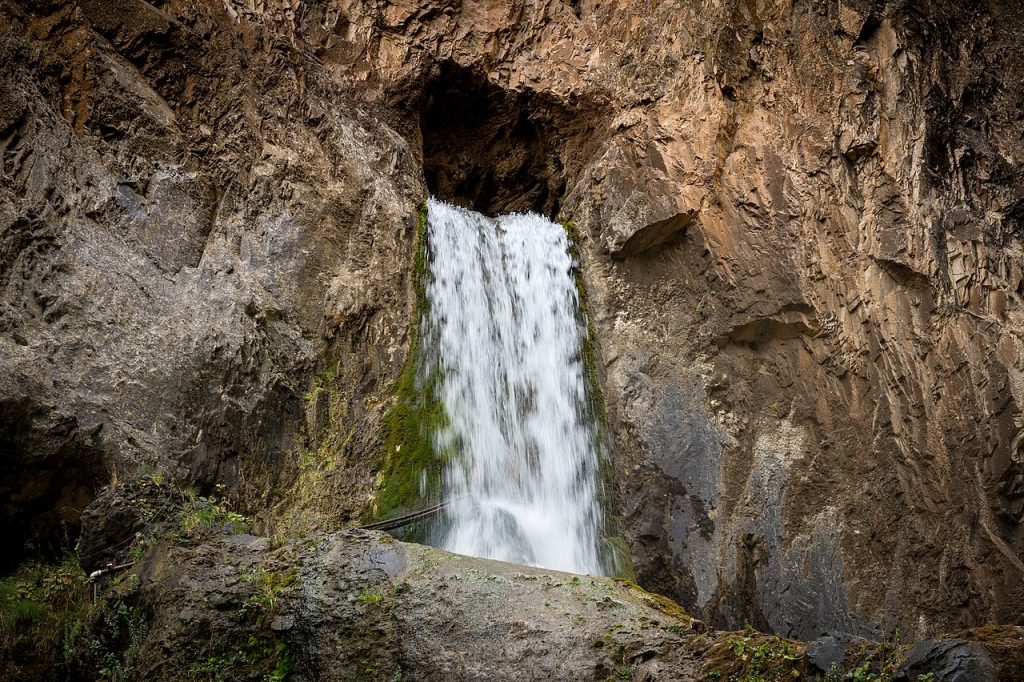
Abshyr-Ata is known for a waterfall emerging from a steep rock face in the Nookat area of Osh Region. The setting combines a compact natural sight with a place that has meaning for local visitors, so it deserves more than a hurried splash-and-photo stop. Access paths may be busy or slippery, particularly close to the water.
Alay Valley
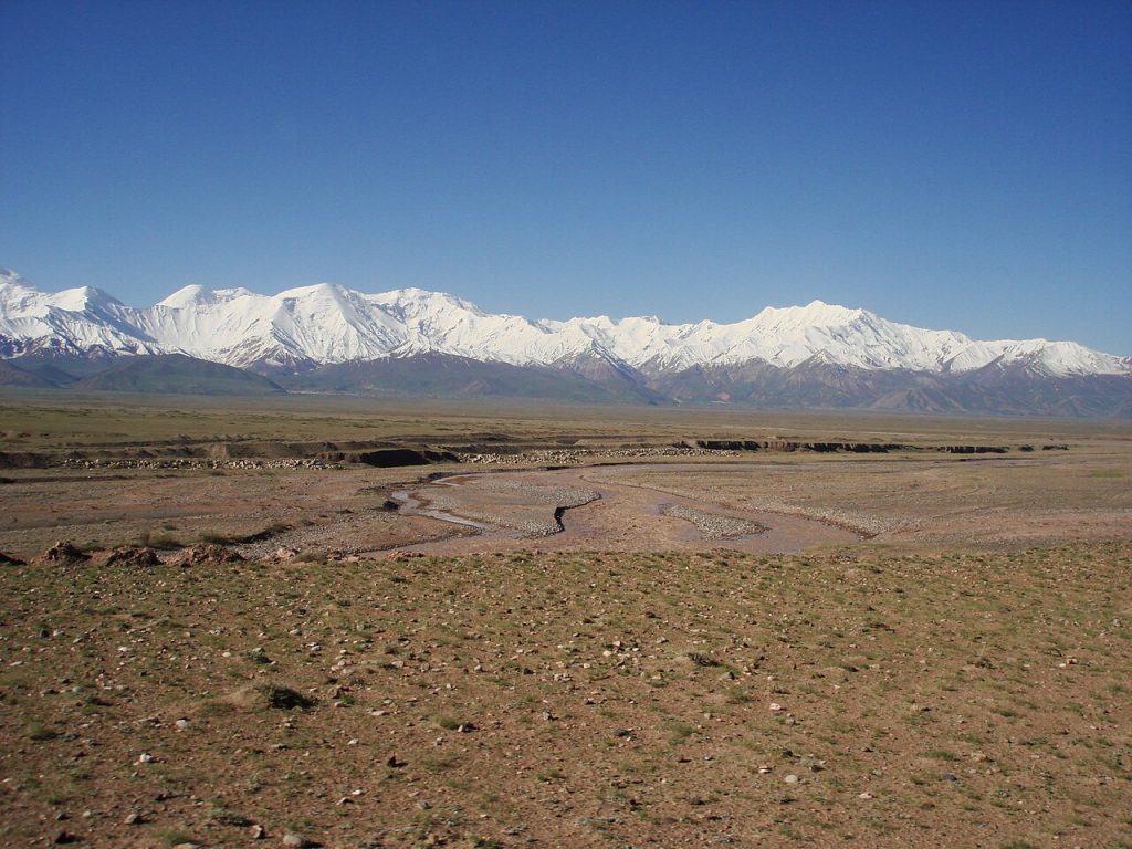
The Alay Valley is a broad high-altitude corridor between major mountain ranges, with long views towards the Pamir peaks. It is a landscape to travel through slowly, using villages as bases for walks, horse rides and onward routes. The eastern and western parts belong to different local administrative districts, and Chon-Alay should not be confused with Alay District.
Tulpar-Kul Lake
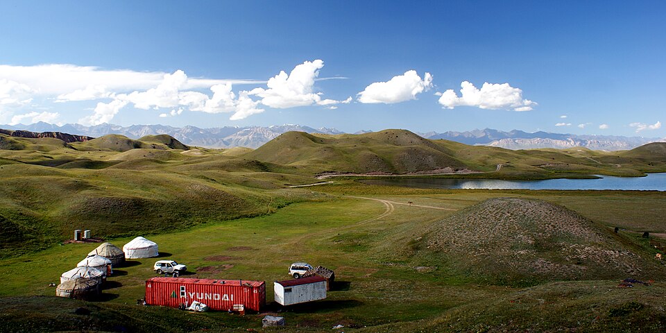
Tulpar-Kul is a high mountain lake destination near the northern approach to Lenin Peak, commonly reached through Sary-Mogol in the Alay Valley. The attraction is the combination of small waters, open pasture and the much larger mountain wall beyond. A lake excursion should be planned separately from a climbing expedition: looking towards the peaks does not require entering glacier terrain.
Batken Region
Kan-i-Gut Cave and Historic Mine
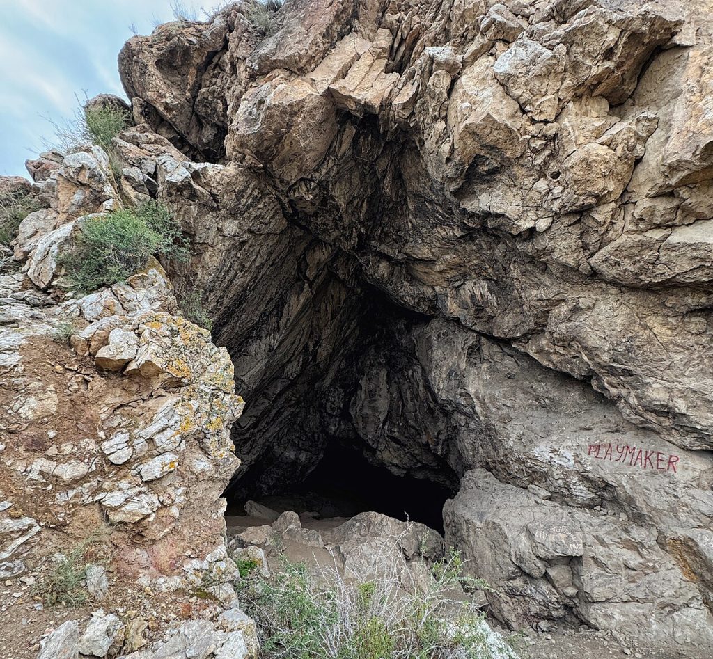
Kan-i-Gut is a complex underground heritage site in Batken Region. It combines natural cave spaces with passages altered or created by mining. Reading it only as a natural cave misses an important part of its history; reading it only as a mine misses the geological processes that shaped the original cavities.
Madygen Geological Landscape
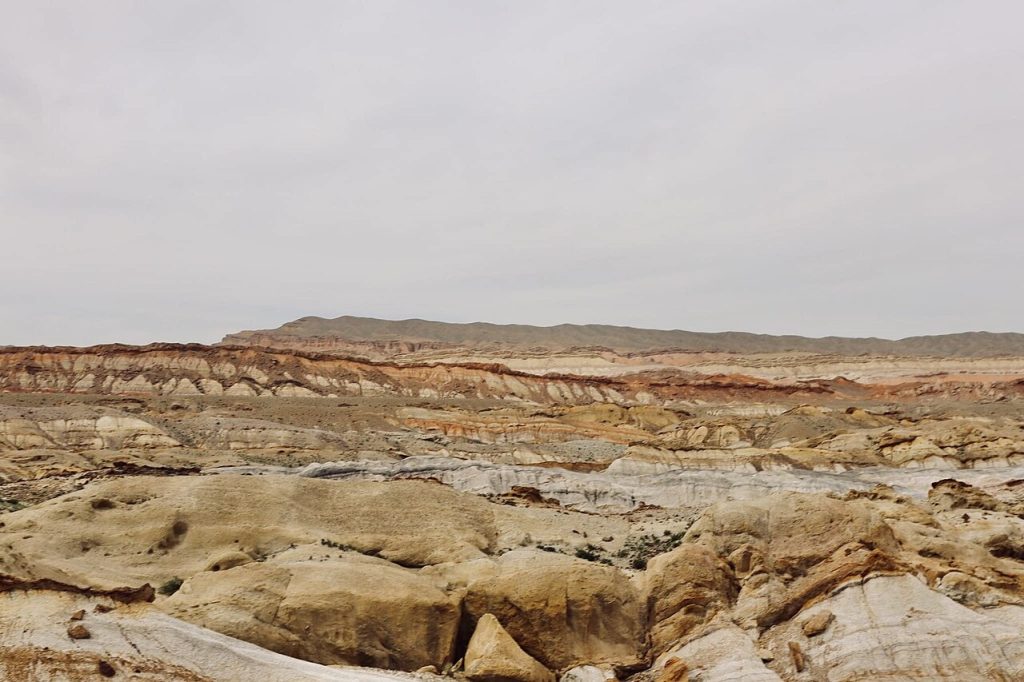
Madygen is a geological landscape in Batken Region where exposed layers and eroded landforms make the deep history of the area visible. It is particularly rewarding with a guide who can relate colours and rock sequences to geological processes rather than simply listing unusual shapes. The wider area is known for scientific interest, so rocks and fossils should remain in place.
Sarkent Nature Park
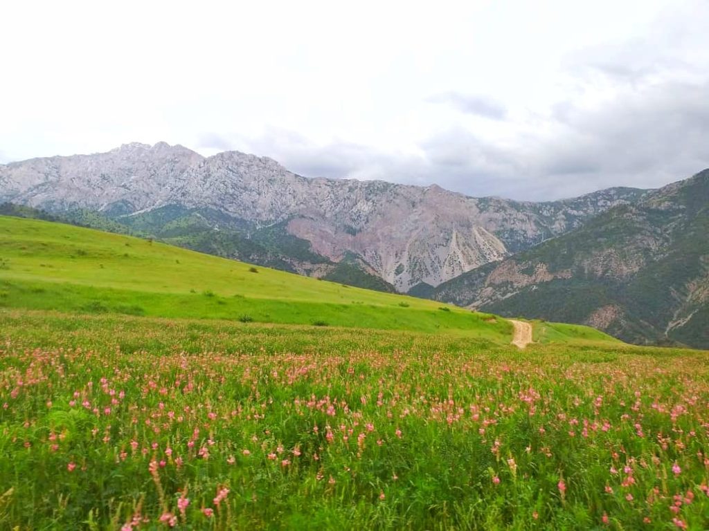
Sarkent is a protected mountain area in the far southwest of Kyrgyzstan, offering a different perspective on Batken beyond its towns and geological landmarks. Its remote setting suits carefully arranged nature travel with local knowledge rather than spontaneous navigation to a general map marker. The park contains varied mountain terrain, and access to specific walks should be confirmed with responsible local contacts.
Karavshin Valley
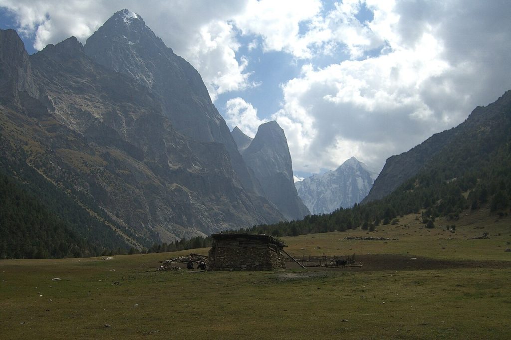
Karavshin is a remote mountain destination in Batken Region, known among trekkers and climbers for dramatic rock scenery. The name covers a valley system rather than a serviced resort, and travelling here calls for an expedition-style plan. Treks and technical climbing have different requirements, while border-area procedures and current local access need checking for the chosen route.